photographs
Library has about 10,000 photographs that were taken by not only the Regional Bureaus but also the municipalities and the companies in the construction industry.
The images are sorted in chronological order from the moment of the occurrence of the earthquake. A list of user-friendly keywords is also provided here.
We will continue to expand our library to include the images of the long reconstruction process that we are going to see in the future.
You may reproduce the materials such as images and videos on this website.
You may also attach the website materials to documents that you prepare. If you want to use the contents of this website, please send describes the following items in the mail. File number of the reprint request , Intended use , Applicant's name , E-mail address.
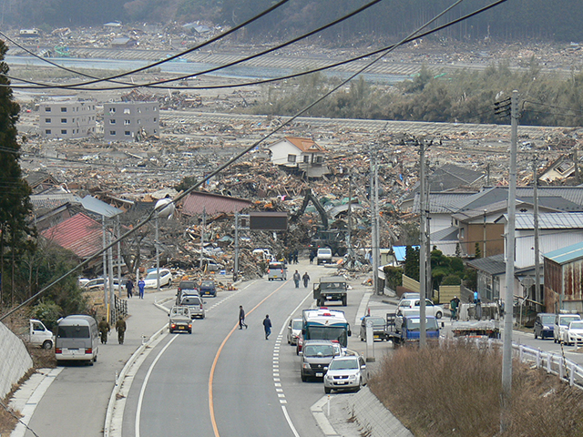
Iwate Rikuzentakata
| Ref. number | 500388 |
|---|
| Location | Iwate Rikuzentakata |
|---|
| Date | 2011:03:15 15:13:51 |
|---|
| Copyright holder | Tohoku Regional Bureau, Ministry of Land, Infrastructure, Transport and Tourism |
|---|
| Search keyword | Clearance clearance working state / Rikuzentakata / Offered material by Iwate |
|---|
| Number of view | 21769 |
|---|
| Explanation | The view overlooking Rikuzentakata City from National Highway No. 340 (one of the roads of the “Operation Teeth of a Comb”). Tsunami runup zone surrounded by tsunami deposit can be seen further down. The difference between the untouched regions closer to view is clear as a day. |
|---|

